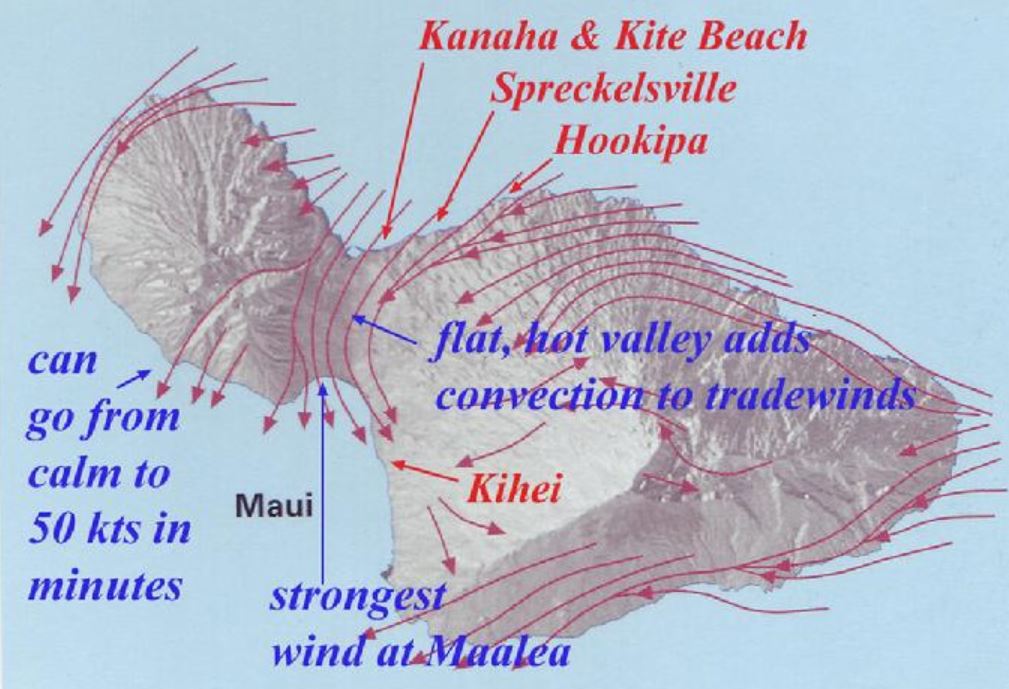
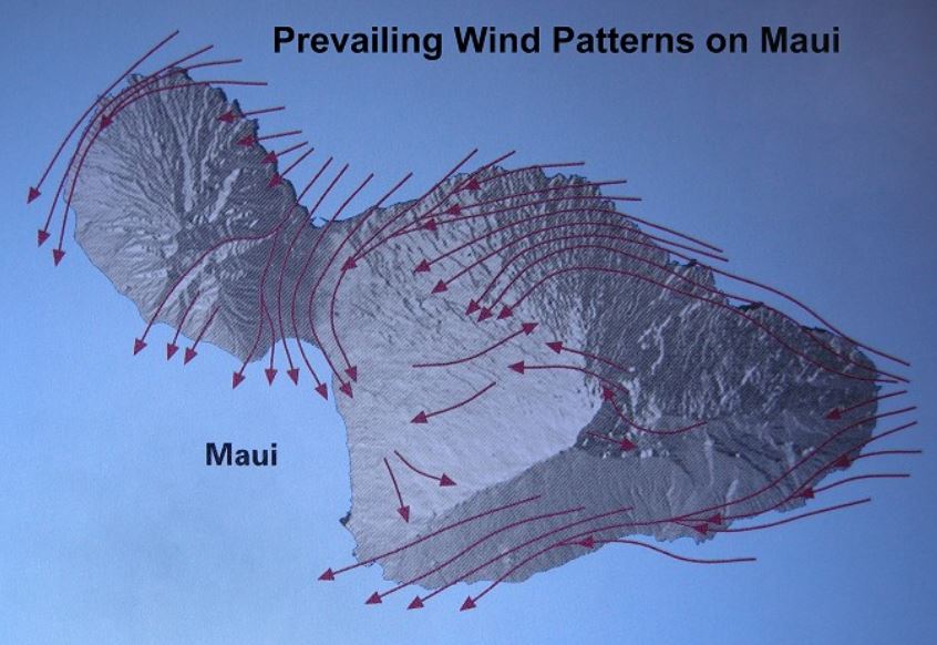
Maui County - Wind Speed Map

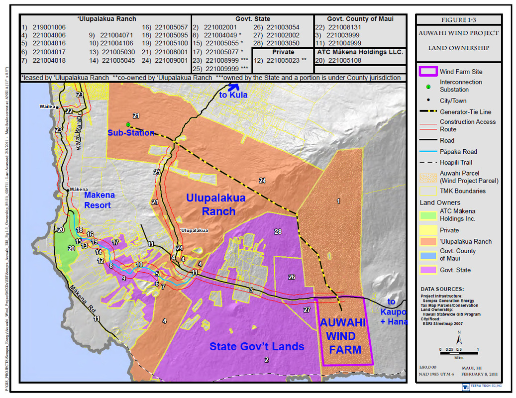
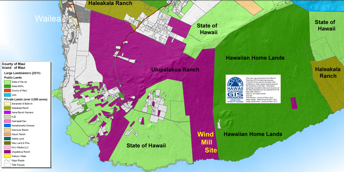
Sempra's Auwahi Windfarm on Ulupalakua Ranch
MAUI ISLAND’S THREE EXISTING WIND FARMS
KAHEAWA WIND POWER I
SYSTEM SIZE: 30 Megawatts (MW)
POWER PURCHASE TYPE: As-available
OWNER-OPERATOR: First Wind (formerly named UPC Wind)
DESCRIPTION: The wind farm consists of 20 General Electric 1.5MW wind turbines on a ridgeline above Ma`alaea in southwest Maui. The wind farm, on state land leased from the Department of Land and Natural Resources, became operational in June 2006. The purchase power agreement with Maui Electric Company was approved by the Public Utilities Commission on March 18, 2005.
KAHEAWA WIND POWER II
SYSTEM SIZE: 21 MW
POWER PURCHASE TYPE: As-available, long-term, fixed-price
DESCRIPTION: In February 2011, the Hawaii Public Utilities Commission approved a power purchase agreement between Kaheawa Wind Power and Maui Electric Company for an additional 21 megawatts (MW) of wind energy, an expansion of the existing 30 MW Kaheawa Wind farm above Ma'alaea. The expanded wind farm is the largest wind energy project in Hawaii. The project also includes a battery energy storage system to assist in meeting performance standards and smoothing fluctuations in wind energy output.
AUWAHI WIND FARM
LOCATION: Ulupalakua Ranch, Southeast, Maui
SYSTEM SIZE: 21 MW
POWER PURCHASE TYPE: As-available, long-term, fixed-price
DESCRIPTION: In April 2011, Sempra Generation, a subsidiary of Sempra Energy, and Maui Electric Company signed a power purchase agreement which was approved by the Hawaii Public Utilities Commission. The project went on-line in December 2012. It includes a battery energy storage unit able to store as much as 12 megawatt-hours of wind energy to regulate and smooth intermittent wind power, providing a valuable source of grid stability for Maui Electric. Project Income helps 18,000-acre Ulupalakua Ranch maintain its agricultural operations.
