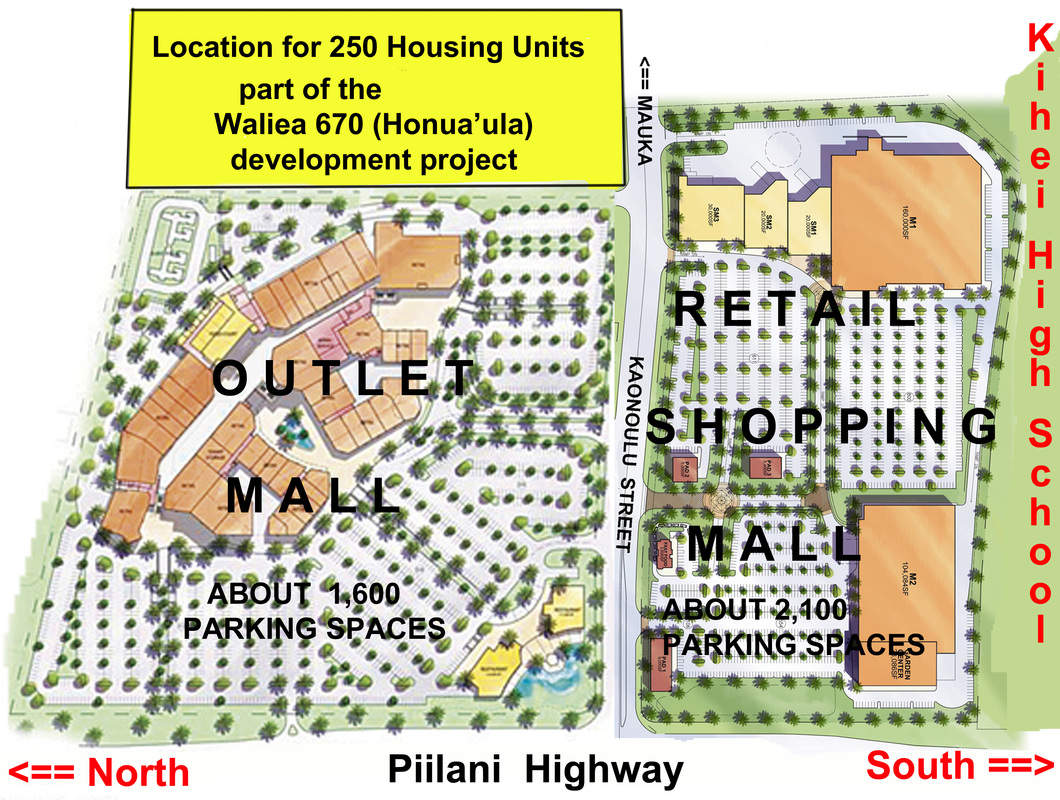
The new KIHEI HIGH SCHOOL
State Land Use Commission Documents
Kihei High School - March 2013 Final Environmental Impact Statement
Proposed Kihei High School (Description from the Final EIS)
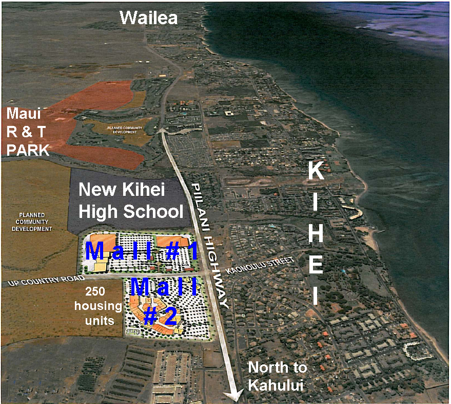
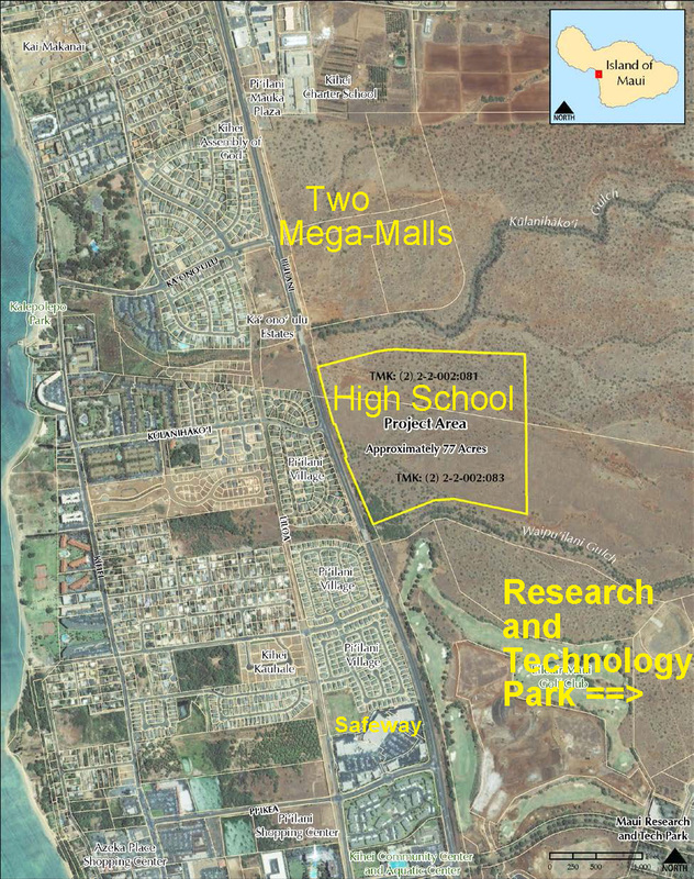
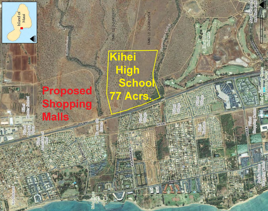
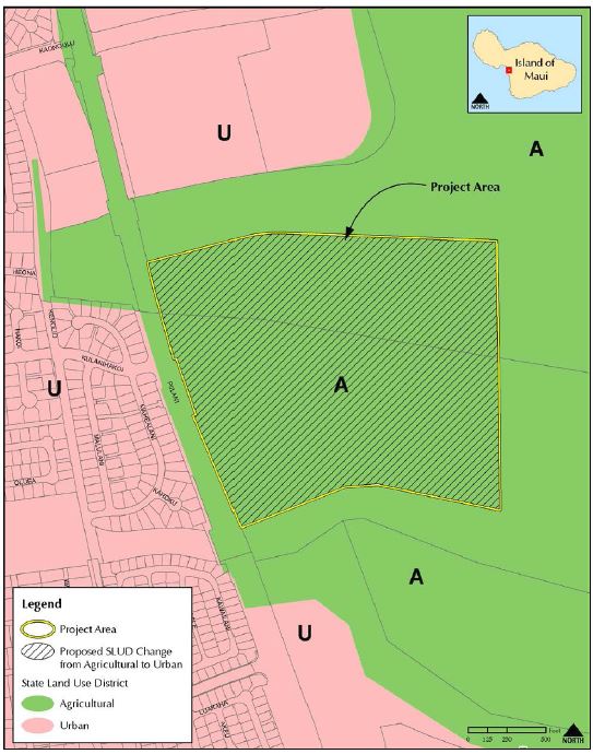
The DOE proposes to develop a new high school campus in Kïhei on 77.2 acres of undeveloped
land mauka of Pi'ilani Highway between Kulanihako'i and Waipu'ilani Gulches on the island of
Maui (Figure 1-1). The proposed school will serve grades 9-12 in the South Maui Region. Site
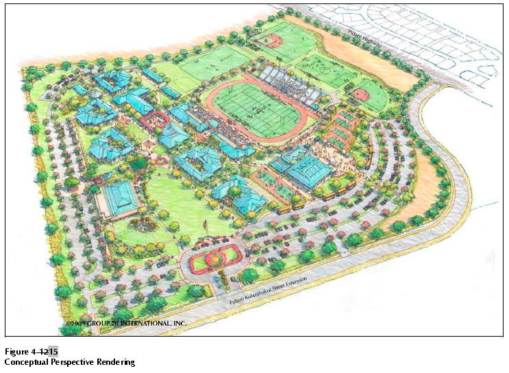
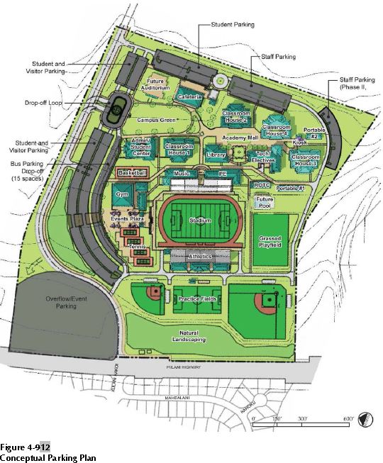
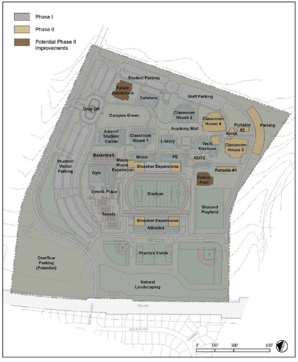
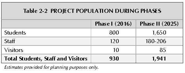
improvements would include construction of approximately 215,000 SF of buildings to support an
enrollment capacity of 1,650 students and approximately 206 supporting faculty and staff. The
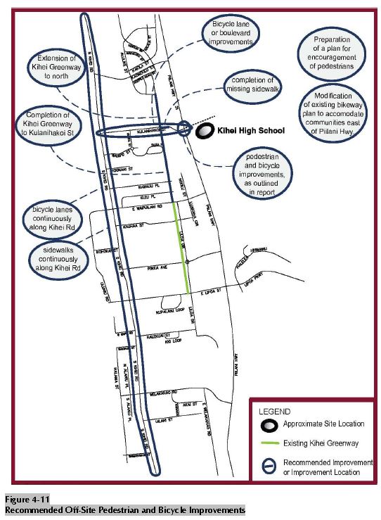
high school will be constructed to meet or exceed the United States Green Building Council (USGBC) Leadership in Energy and Environmental Design (LEED) Silver certification, or comparable rating system. The campus also will include athletic fields (e.g., tennis, track and field, football, soccer, baseball and softball fields, and swimming pool) and associated infrastructure improvements (e.g., new roadways, utilities, drainage, wastewater and water systems). An extension of Kulanihako'i Street mauka of Pi'ilani Highway will serve as the main campus access road.
The Kïhei High School project requires land use entitlements including a State Land Use District Boundary Amendment from Agricultural to Urban, an amendment to the County of Maui’s Kïhei-Makena Community Plan from Agriculture and Public/Quasi-Public to Public/Quasi-Public, a change in Maui County Zoning from Agricultural to P-1 Public/Quasi-Public, and final subdivision and consolidation approval to allow for the development of the 77.2-acre high school campus. It is a goal of the proposed development that the school will not only serve the enrolled youth, but be a center for the Kïhei community. Kïhei High School will provide opportunities for employment (both short and long-term) within the Kïhei-Makena area.
land mauka of Pi'ilani Highway between Kulanihako'i and Waipu'ilani Gulches on the island of
Maui (Figure 1-1). The proposed school will serve grades 9-12 in the South Maui Region. Site
improvements would include construction of approximately 215,000 SF of buildings to support an
enrollment capacity of 1,650 students and approximately 206 supporting faculty and staff. The
high school will be constructed to meet or exceed the United States Green Building Council (USGBC) Leadership in Energy and Environmental Design (LEED) Silver certification, or comparable rating system. The campus also will include athletic fields (e.g., tennis, track and field, football, soccer, baseball and softball fields, and swimming pool) and associated infrastructure improvements (e.g., new roadways, utilities, drainage, wastewater and water systems). An extension of Kulanihako'i Street mauka of Pi'ilani Highway will serve as the main campus access road.
The Kïhei High School project requires land use entitlements including a State Land Use District Boundary Amendment from Agricultural to Urban, an amendment to the County of Maui’s Kïhei-Makena Community Plan from Agriculture and Public/Quasi-Public to Public/Quasi-Public, a change in Maui County Zoning from Agricultural to P-1 Public/Quasi-Public, and final subdivision and consolidation approval to allow for the development of the 77.2-acre high school campus. It is a goal of the proposed development that the school will not only serve the enrolled youth, but be a center for the Kïhei community. Kïhei High School will provide opportunities for employment (both short and long-term) within the Kïhei-Makena area.