M A U I R E S E A R C H a n d T E C H N O L O G Y P A R K
Maui R&T Park's Website
Two large documents with details of the proposed Maui R&T Park expansion.
R&T Park Final Environmental Impact Statement (March 2013) Volume 1 + 2
R&T Park Final Environmental Impact Statement (March 2013) Volume 3 + 4
1. Many entitlements and permits will be needed.
2. Project seeks entitlements for 1,250 dwelling units (Volume 1, Page 64)
3. Project seeks 2,000,000 sq.ft. of industrial/commercial space (Volume 1, Page 64)
Permits Needed: State Land Use District Boundary Amendment;
County Community Plan Amendment; County Change in Zoning;
Section 404 Clean Water Act Approval; Air Pollution Control Permit; Community Noise Permit; NPDES Permit; Section 401 Clean Water Act; Well Construction and Pump Installation Permit; Stream Channel
Alteration Permit; Permit to Perform work within the State ROW; Preliminary Subdivision Approval; Final Subdivision Approval; Grading and Grubbing Permit; Driveway Permit; Building Permit; Wastewater Discharge Permit; Drainage Approval; Easements for Utilities and Roadways
Applicant: Maui R&T Partners, LLC., 1300 North Holopono St., Suite 201, Kihei, HI 96753.
Contact: Mr. Steve Perkins, (808)-270-5944
Consultant: Chris Hart and Partners, Inc., 115 N. Market St., Wailuku, HI 96793
Contact: Mr. Brett Davis, (808) 242-1955
Status: FEIS already accepted by State Land Use Commission.
Many other project approvals pending.
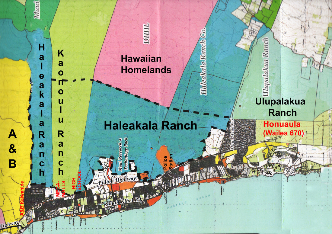
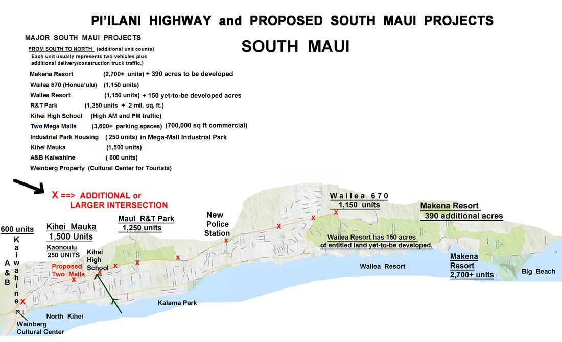
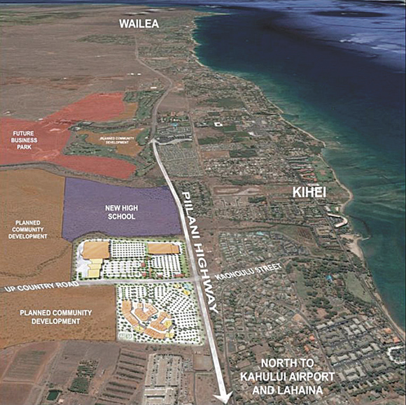
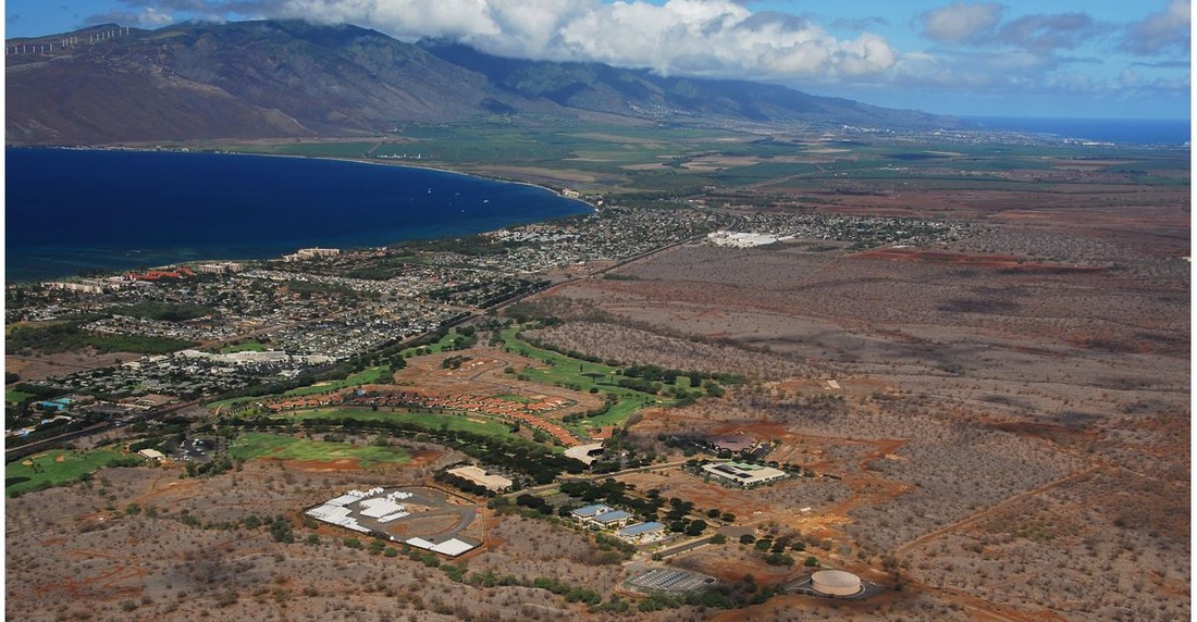
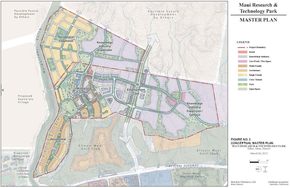
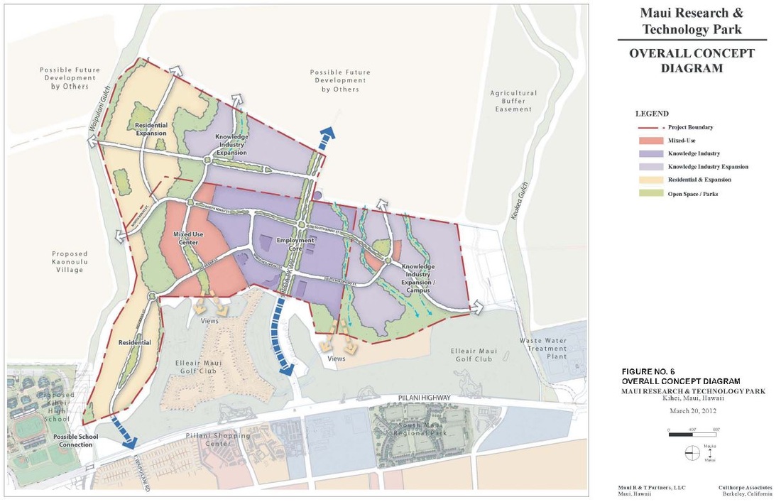
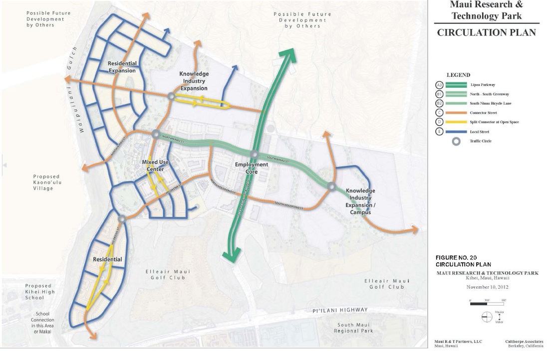
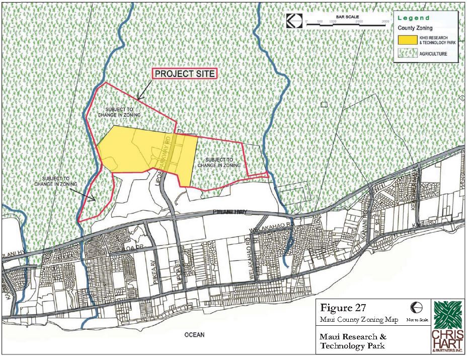
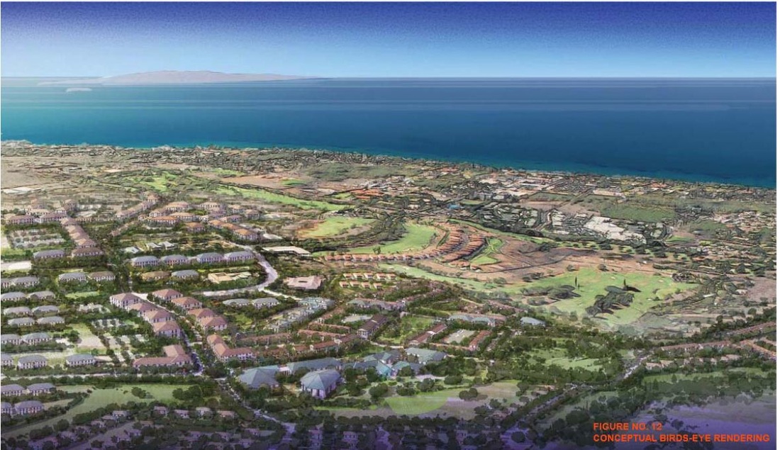
The Maui Research and Technology Park (MRTP) is located in Kihei, Maui. The Park is situated mauka (east) of Piʻilani Highway and is accessible from Lipoa Parkway. The MRTP encompasses approximately 411 acres owned in fee simple by various land owners and is proposed to include 1,250 housing units and 2,000,000 sq. ft. of industrial and commercial space..
MRTP was established in the 1980’s to bring diversification to Maui’s economy through investment in high technology. Today the Park has over 180,000 square feet of office space, with over 400 people working at over 20 high technology and professional services companies.
Over the next 20 years, the Park desires to strengthen its competitive position by better servicing the unique needs of the knowledge industry community. The Park will accomplish this objective by incorporating greater flexibility into its land use controls. The Park will also embrace mixed-use development by bringing housing choices and personal and professional services within walking and biking distance of work.
The park will be developed in two phases. Phase 1, through 2024, will include a mixed-use
village center, knowledge-industry employment core, residential neighborhoods, schools and parks. Phase 2, through 2034, will include additional residential development and knowledge industry expansion campuses to the east and south. At build-out, in 2034, the Park will comprise knowledge industry, commercial, and civic uses.