MAUI ISLAND PLAN - Adopted December 28, 2012
MAUI ISLAND PLANThe Maui General Plan has 3 Components:
1. The Countywide Policy Plan was adopted in March 2010. 2. The MAUI ISLAND PLAN was adopted on 12-28-2012. Its “Implementation Chapter” is yet to be adopted. 3. NEXT UP: Review of Maui Island’s six community plans: West, South, Central, Upcountry, North, and East Maui ---------------------------------- The December 2012 Maui Island Plan is the result of a six year effort by the General Plan Advisory Committee (GPAC), the Maui Planning Commission, the Planning Department and the Maui County Council. It is intended to form a framework for the community plans and the actions of our County and State governmental departments. See Maui County Code 2.80b for a description of the legal basis of our General Plan. Cover/Title Page · Acknowledgments · Executive Summary · Table of Contents · Introduction · Chapter 1: Population · Chapter 2: Heritage Resources · Chapter 3: Natural Hazards · Chapter 4: Economic Development · Chapter 5: Housing · Chapter 6: Infrastructure and Public Facilities · Chapter 7: Land Use · Chapter 8: Directed Growth Plan -- Directed Growth Maps <Here are the “growth boundaries”. -- Protected Area Diagrams · Chapter 9: Monitoring & Evaluation · Works Cited, Photo Credits & Erratum · -- Appendix A. Glossary -- Appendix B. Maui Island Plan Map Book <==Detailed maps. Chapter 10. Implementation (Council Planning Committee Proposal - May 2014) |
|
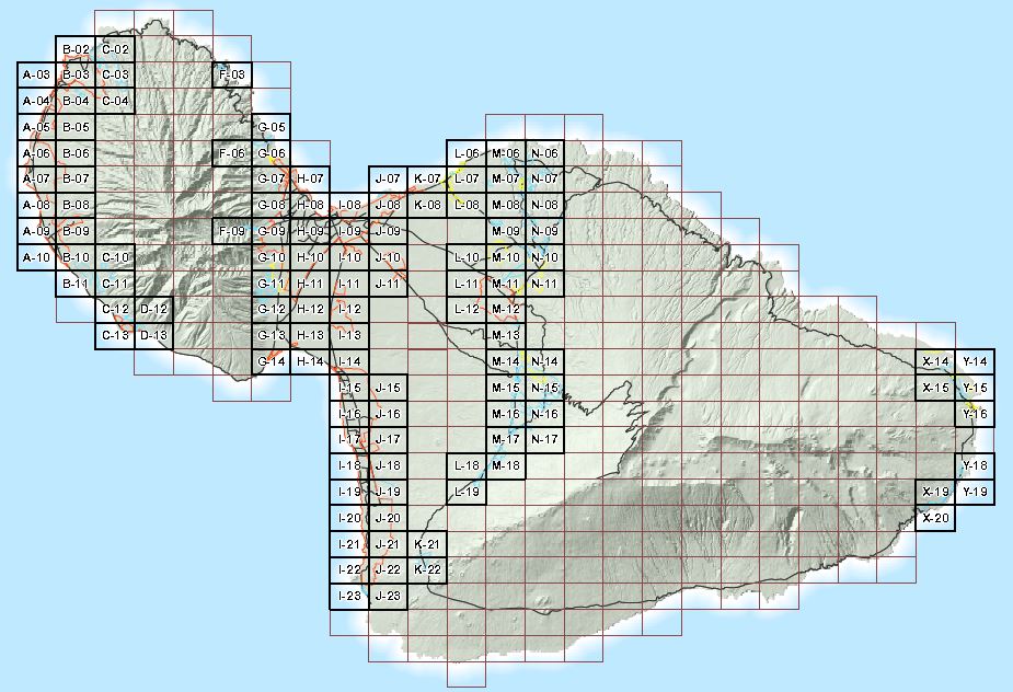
Each of the little rectangle areas on the map below can be seen in great detail on the following website.
Use the code numbers on the rectangles below to find detailed maps which are in alphabetical sequence.
Use the code numbers on the rectangles below to find detailed maps which are in alphabetical sequence.